B.L. Freeborn © December 2025
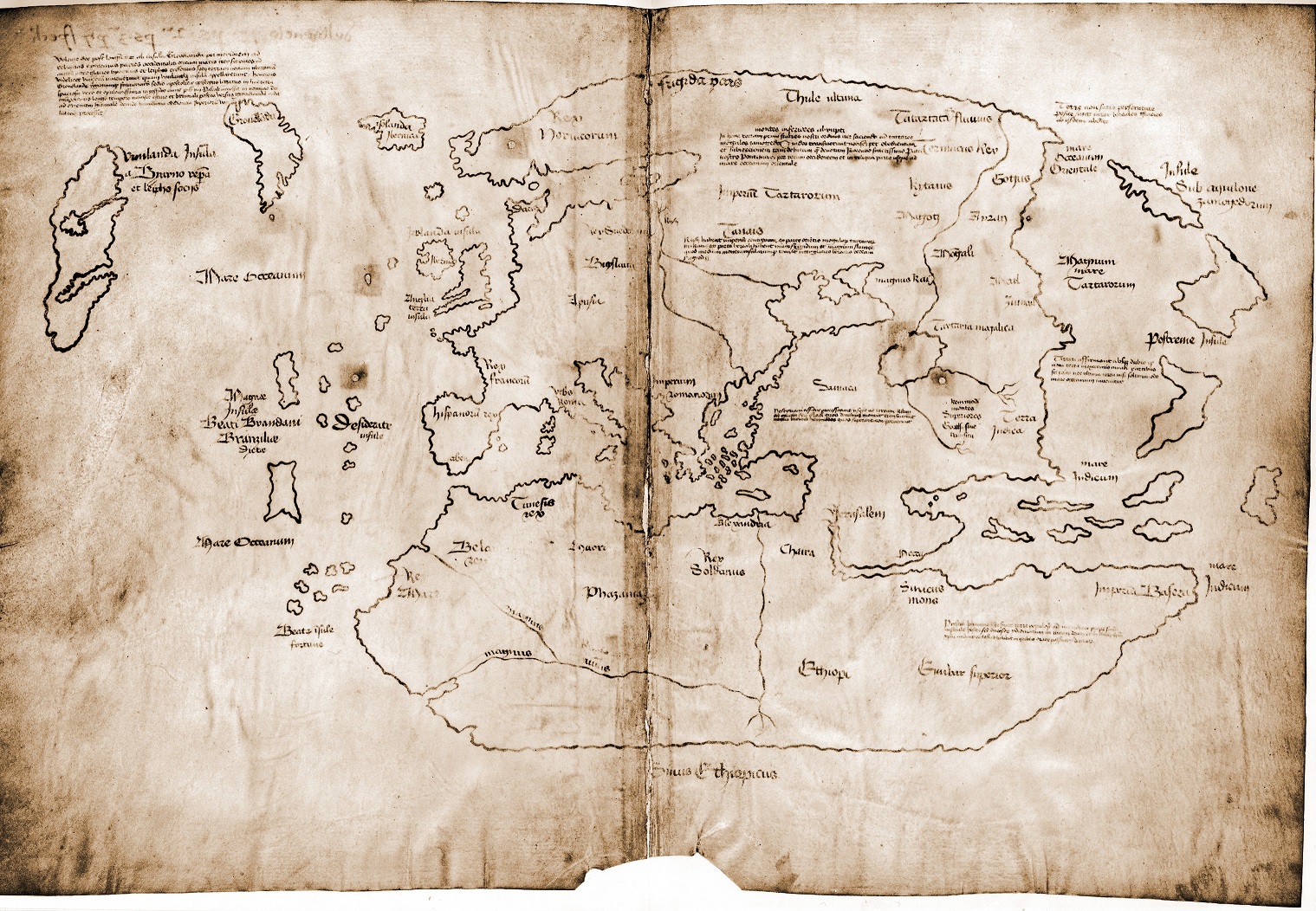
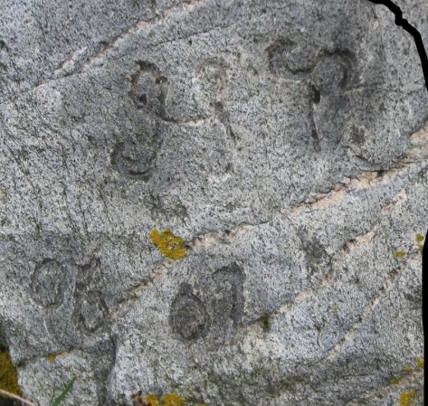
Vinland Map. Photo by Yale University.
The Vinland Map is probably one of the most important documents from the 12th century ever to have been written. Since the nay-sayers have once again had their way, the only remaining copy has been stowed away to be forgotten.
Raymond Clemens, a curator at Yale University’s Beinecke Rare Book & Manuscript Library has declared it a fake based on ink studies. You can read all the negativity elsewhere.
But perhaps Mr. Clemens can explain why it is so very boldly signed?
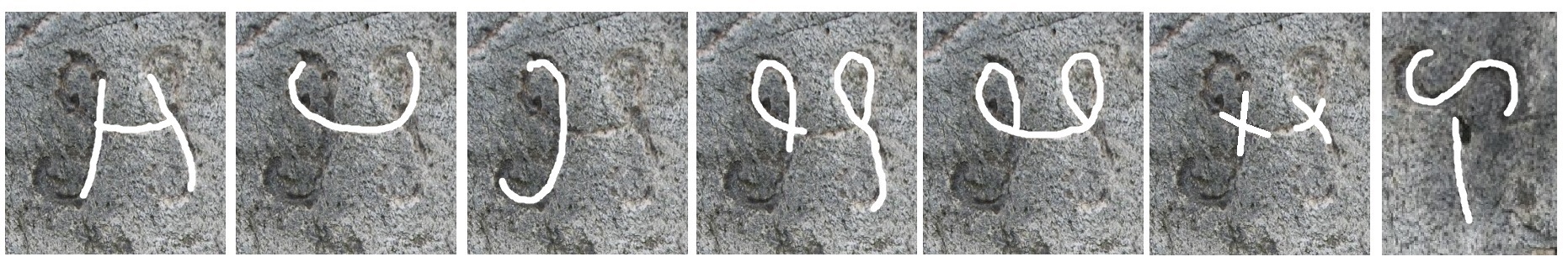
Perhaps he noticed it is a lengthy and vastly complicated narrative written in anagrams?
After having studied the anagrams for over a year, this author saw something, something very important, something deliciously important. Care to find out? Of course you do. You are not going to want to miss this one. It is so full of gems, one could say it is a treasure map!
Fortunately, there are copies to be had. Here is a link to an enhanced photo of the one and only perfect copy still in existence. Got that clue. The Vinland Map, the one Clemens would toss is a perfect copy. So, when you view said map remember you are going to need three perfect copies. And you will need three perfect copies in – mirror image – to see what is actually there. (Print with the thinnest paper you have.) OK. Perhaps you don’t need all six copies to start but you certainly need one of each unless you want to go blind looking at it against a mirror.
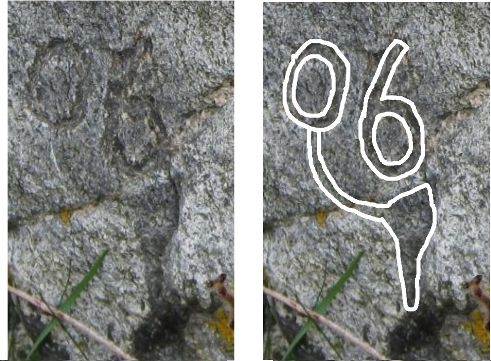
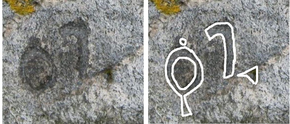
First task – find the author’s signature. Here is a clue:
There are one hundred random capitals in the legends. There are only two repeated legends: Legend #59: mare Indicum and Legend #60: Mare Occeanum.
These have capitals: I OM.
 You are correct to ask who is OM. If one studies the largest legend, in the upper left corner which is written in Latin, one will find it talks about Vinland, hence the map’s name. This English translation is from ‘The Vinland Map and the Tartar Relation’ (VMTR); Yale University Press, 1965, pg. 140.
1 ‘By God’s will, after a long voyage from the island of Greenland to the south toward
2 the farthest remaining parts of the western ocean sea, sailing
3 to the south amid ice, the companions Bjarni and Leif Eiriksson discovered a new land, extremely fertile
4 and even having vines, which island they named Vinland. Henricus,
5 legate of the Apostolic See and bishop of Greenland and the neighboring regions,
6 arrived in this truly vast and very rich land, in the last year of our most blessed father Pascal in the name of God the
7 Almighty. He remained a long time summer and winter and later returned toward Greenland
8 northeastward and then in the most humble obedience to the will of his superiors
9 proceeded…’
R.A. Skelton, Thomas E. Marston and George O. Painter were the first to study the map in 1957. When they published VMTR in 1965, they believed in its authenticity. They thought Bishop Henricus was during the time of King Sigurd the Crusader of Norway (circa 1118). Skelton and co-authors made a small error. This Sigurd co-ruled with his older brother King Oystein Magnusson. This King died coincidently the same year as Henricus in 1123. The throng in attendance at his funeral was unbelievably large. He was an exceptional man and very well loved. But read that closing line of the legend again. “ …then in the most humble obedience to the will of his superiors proceeded…” Who was his superior? Is he referring to the Pope, God or Sigurd?
Here’s the thing about these two brothers. There was no love. Sigurd’s weapon of choice was the sword and Oystein’s was the pen. As a boy Sigurd traveled with his father, King Magnus Barefoot and was made King of the Isles at age nine. He became King of Norway with his two brothers in 1103. The youngest brother died in 1115 leaving the two elder to co-rule. As an adult, Sigurd traveled as a crusader. We know today what that entailed.
Oystein also wanted to travel. But because of the Bans against the Old Gods he could not freely travel to his desired destination. In order to travel there he fabricated a persona named Henricus. Then he used his kingly pen and powers to declare Henricus a Bishop and sent him as the legend above says to Vinland.
Where then did Sigurd think the King was during this period of time? Evidently, if the anagrams say what they seem to say, he was touring the British Isles. He just needed a few friends to lie about his whereabouts while he was gone. He was so beloved by everyone, he was welcome everywhere, except perhaps by King Henry of England. Hence, the moniker: Henri – cus. Yeah, Henry started out loving Oystein but then maybe not so much.
So, before this story continues, find the map makers signature.
To be continued! Next post in about a week.
Similar Articles by same author:
** For numeric background see:
**Freeborn, B.L., Validating North American Runic Inscriptions, noahsage.com, November 2022. PDF only.
Freeborn, B.L., The Vinland Map Ciphers, noahsage.com, December 2025. Book only see post.
Freeborn, B.L., The Vinland Map Ciphers Addendum, noahsage.com, December 2025. PDF only.
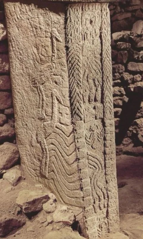
Freeborn, B.L., Ancient Riddles to Test Our Wits: The Secret Chamber, noahsage.com, January 2016. Post here.
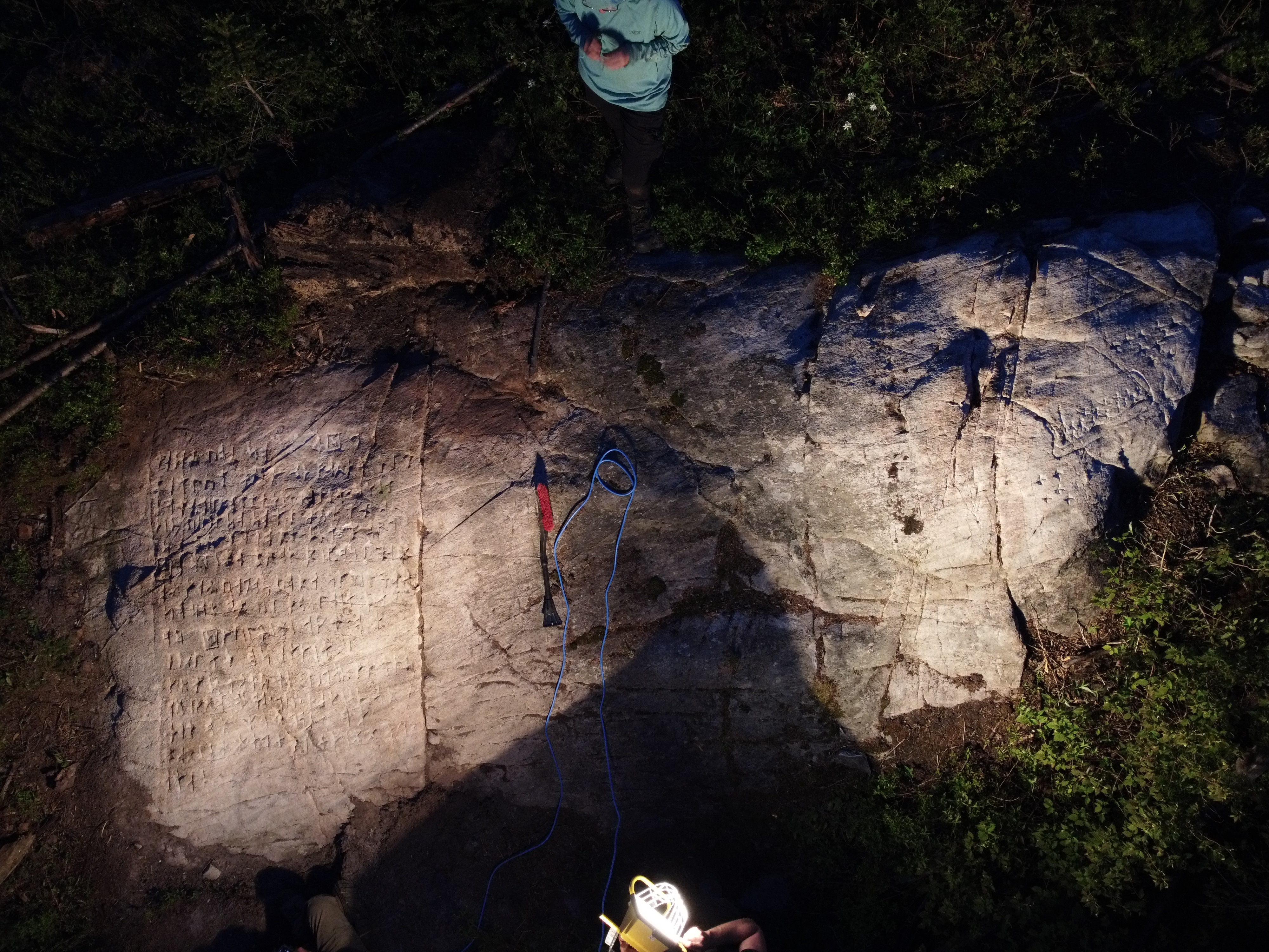
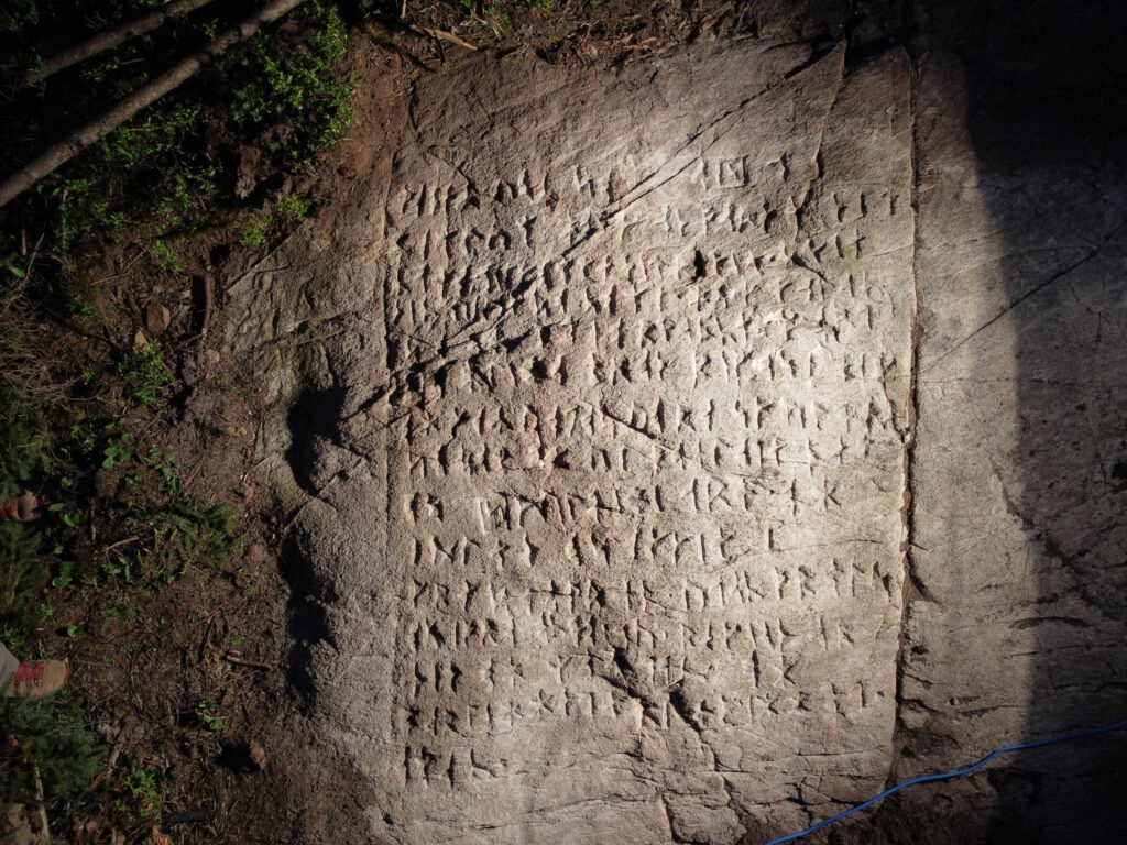
Freeborn, B.L., Another Riddle in Stone from Canada, noahsage.com, August 2025. Post here.
Freeborn, B.L., Deciphering the Spirit Pond, Nomans Land and Narragansett Runic Inscriptions, noahsage.com, November 2022. Amulet post. Map stone post. PDF only.
Freeborn, B.L., Et in Arcadia Ego – OUOSVAVV DM – Deciphered, noahsage.com, December 2022. Post here.
Freeborn, B.L., Kensington Rune Stone: A New Translation, noahsage.com, February 2023. Post here.
Freeborn, B.L., Runic Riddles: Time Capsules, noahsage.com, December 2022. Post here.
Freeborn, B.L. The Long Debated Bourne Stone, noahsage.com, January 2023. Post here.
Freeborn, B.L., The Nomans Land – Leif Eriksson Inscription, noahsage.com, December 2022. Post here.
Freeborn, B.L., The Narragansett Inscription: A Translation with its Date of Dedication, Author and Inscriber, noahsage.com, October 2022. Post here.
Freeborn, B.L., The Newport Tower: Finding the Date of Dedication, its Designer and Builder, noahsage.com, October 2022. Post here.
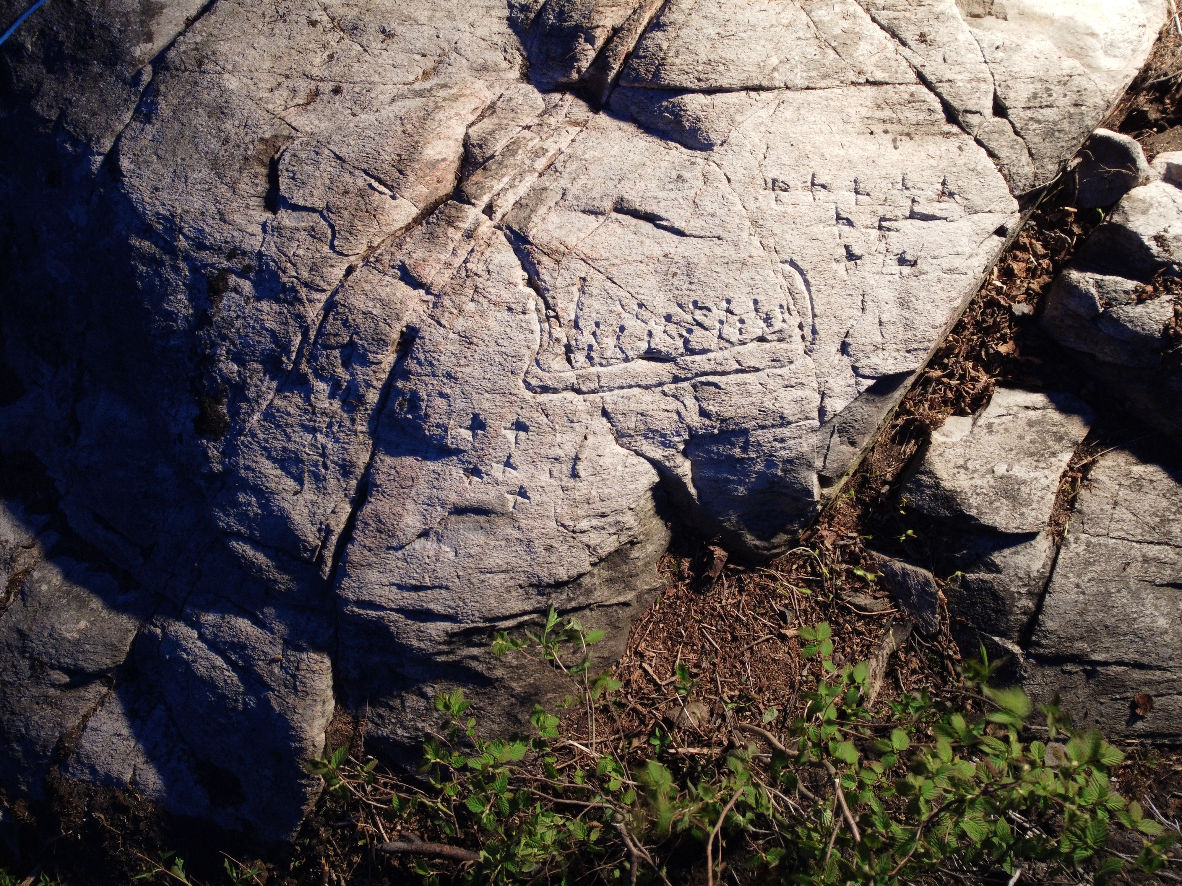
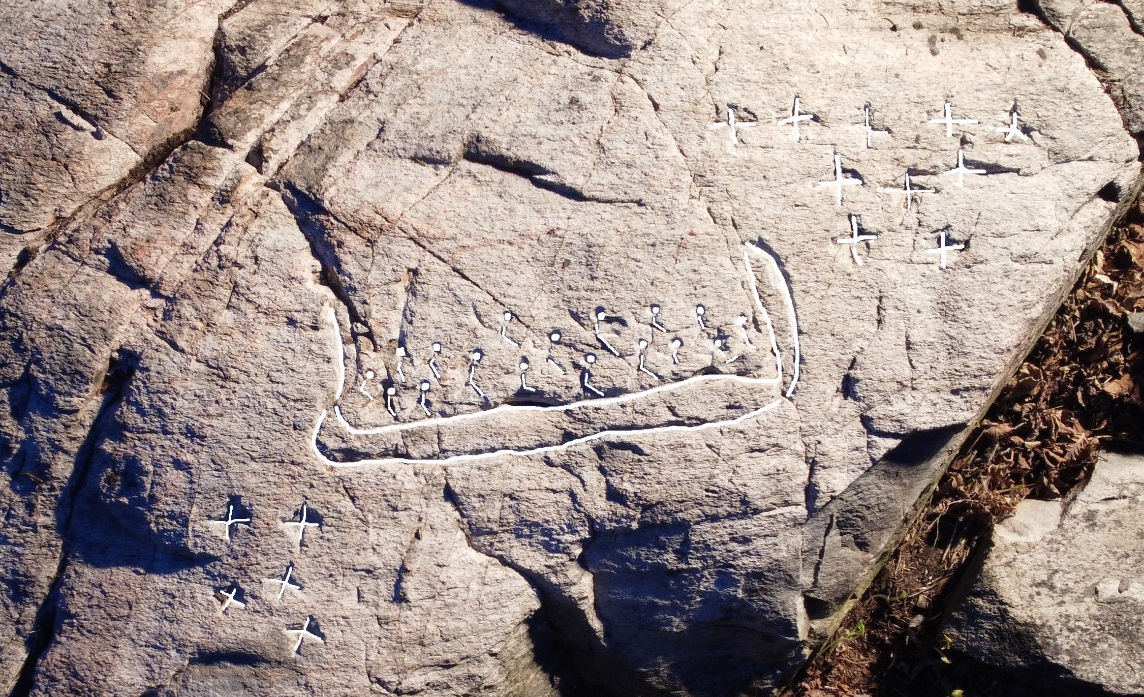
Freeborn, B.L., The Wawa Stone and Its Viking Ship, noahsage.com, August 2025. Post here.
Freeborn, B.L., Rok Rune Stone and its ciphers, noahsage.com, November 2024. Post here.


